Tagged: Roadbook rally waypoint
-
AuthorPosts
-
17 November 2022 at 10:33 am #773
 João PereiraKeymaster26 November 2022 at 7:03 pm #783
 xtractifParticipant
I have the Roadbook and Gmap set up in split screen
is it possible to link Rb points to map waypoints
i think tripy does this?
great app keep up good work
cheers
Mike
28 November 2022 at 9:36 am #788João PereiraKeymasterI have the Roadbook and Gmap set up in split screen is it possible to link Rb points to map waypoints i think tripy does this? great app keep up good work cheers Mike
Our Roadbook is basically a mimic from an analog roadbook. It scrolls a PDF file just like a real roadbook would scroll a paper roll.
As far as I remember tripy uses something like Open Rally, which when you design a Roadbook in Rally Navigator you can export it in that format.
The advantage of Open Rally format is that instead of being a static PDF file it is more like an XML GPX file.
With the Open Rally format the app is the one drawing the roadbook line by line according to the data in the file.
It also allows the app developers to do A LOT MORE, because now the app is totally aware of all the details of each line, like location, distances, heading, etc.
In theory with Open Rally the app can even show you Roadbook and GPX at the same time with the same file.
The app can show you heading to next waypoint, can scroll paper automatically, can reroute if you get outside the track, etc etc etc the limitations are just in the app developer imagination.So while we dont have Open Rally yet we are going to fully support it in a GLORIOUS way, including specific tools for Event Organisers!
Our only limitation is man power, we are a small team so thing take a while to be done!
DMD2 Project Manager & Lead Developer
Buy Me a Coffee15 January 2023 at 9:46 pm #834RichardParticipantHi John,
The above example is a complex approach. May I suggest to add a function like rallyblitz at the already existing roadbook function. This would create a widget or overlay witch will act on an co-existing gpx File. Software like rally navigator can make this very easy, see this video as an example.
Good luck and keep up the good work!
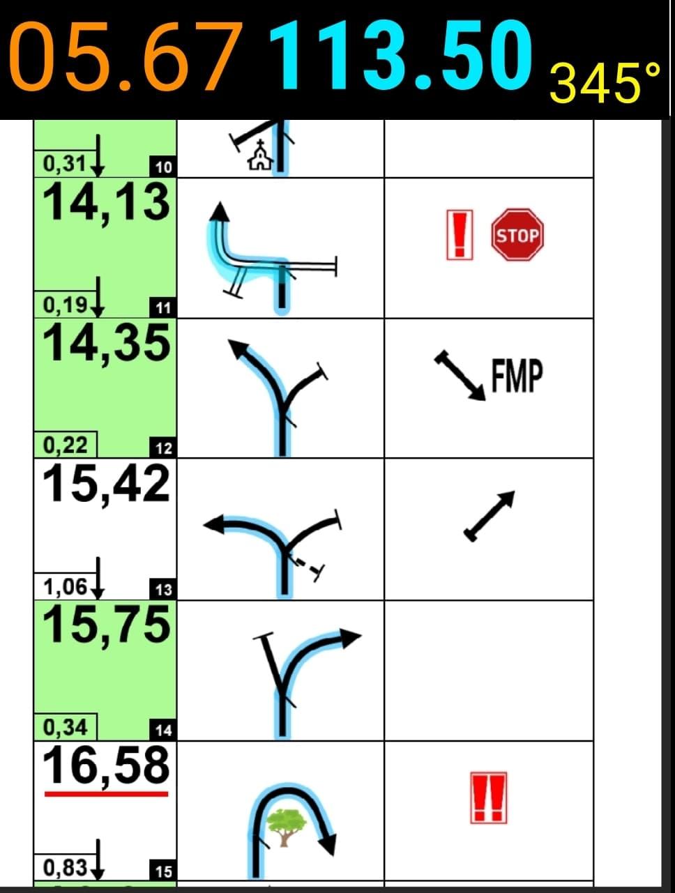
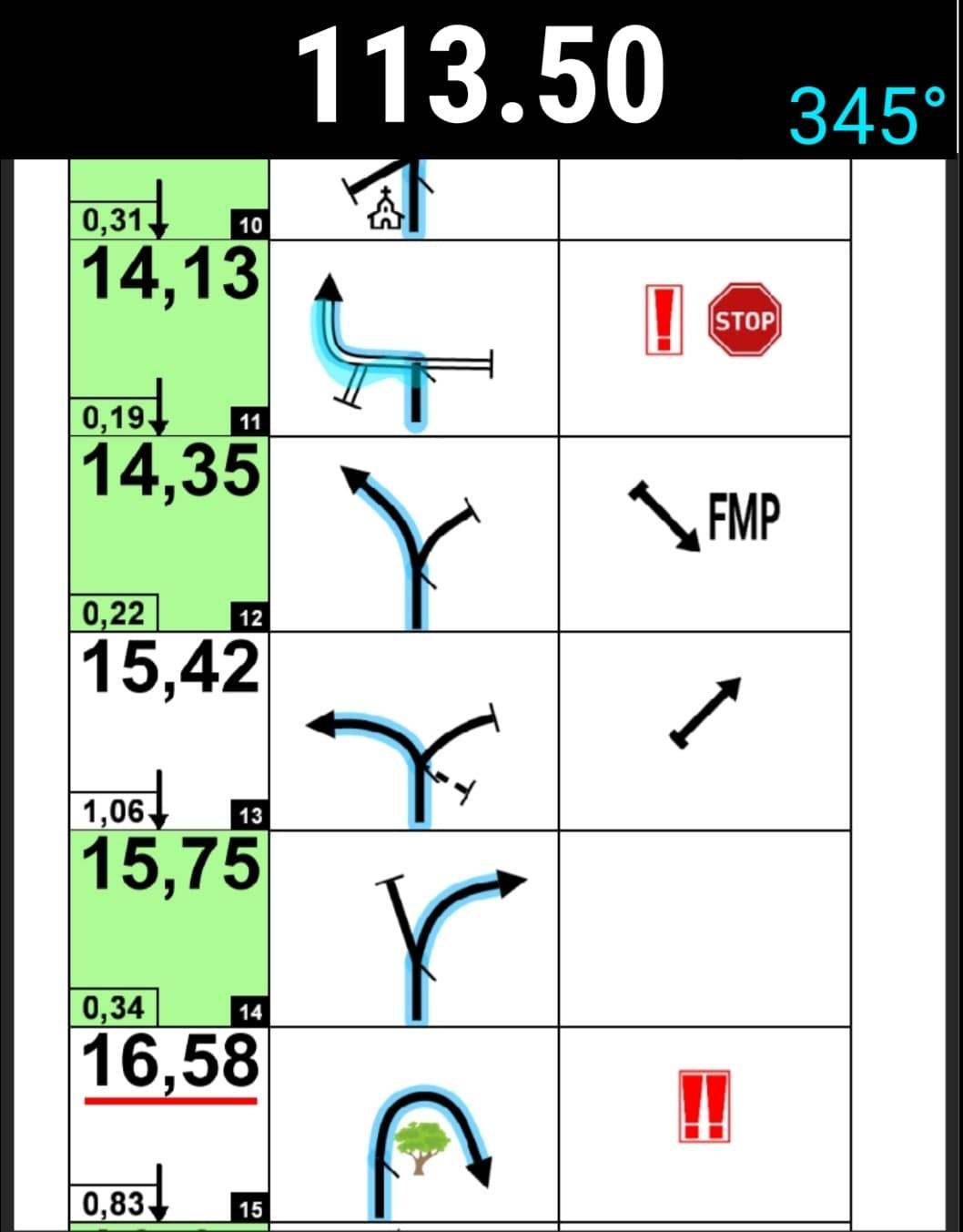
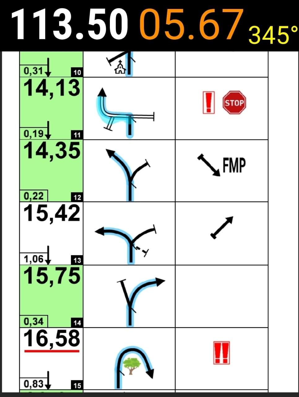
22 August 2023 at 11:33 am #1475jimmiParticipantHi this looks really good, do you have a picture of the layout vertical?
How much of the graphic can you hide? Only asking because it could great to get as much roadbook as possible on the screen (most tulips), and numbers that you easily can see (maybe numbers you can customize in size and color), so you only have what you need.
Graphics are nice to look at but when your racing you just need it as simple and effective as possible.
I know you get a lot of suggestions from all over. Hard to please everybody I know:) This was just some wishfull thinking from a guy who use your app for races, and enjoy it big time!
Examples of what I mean…
 20 October 2023 at 12:58 pm #3210DasMattiParticipant
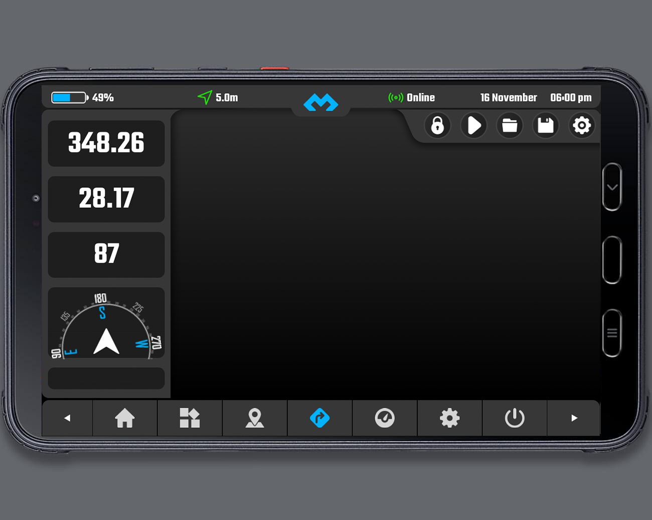
Would it please be possible to delete one of the trip meters?
In the non-beta version this is possible.It would be very helpfull, since some riders don’t rely on the partial trip meter.
It would be nice to only have one trip meter, but much bigger.
Please see, how you solved that in the non-beta version.
I was very happy there.Thanks a lot.
Greetings
-
AuthorPosts
- You must be logged in to reply to this topic.